BY NATHAN GUMA
WHEN climatic shocks such as droughts and unpredictable weather continuously hit the country over the past years, it became difficult for both farmers and insurance companies to determine the amount of damage for accurate payouts.
This raised a risk of under- and over-insurance, which would result in farmers being penalized under a policy of insurance. However, over-insurance would not result in overpayment of the claim by the insurers.
Underinsurance refers to a situation where a farmer insures their crop for less than its actual value or area.
However, Minerva Risk Advisors, an insurance broker, is now using geospatial data to promote accuracy in quantifying damage, while predicting potential risks.
This is revolutionising short-term insurance in the agricultural sector.
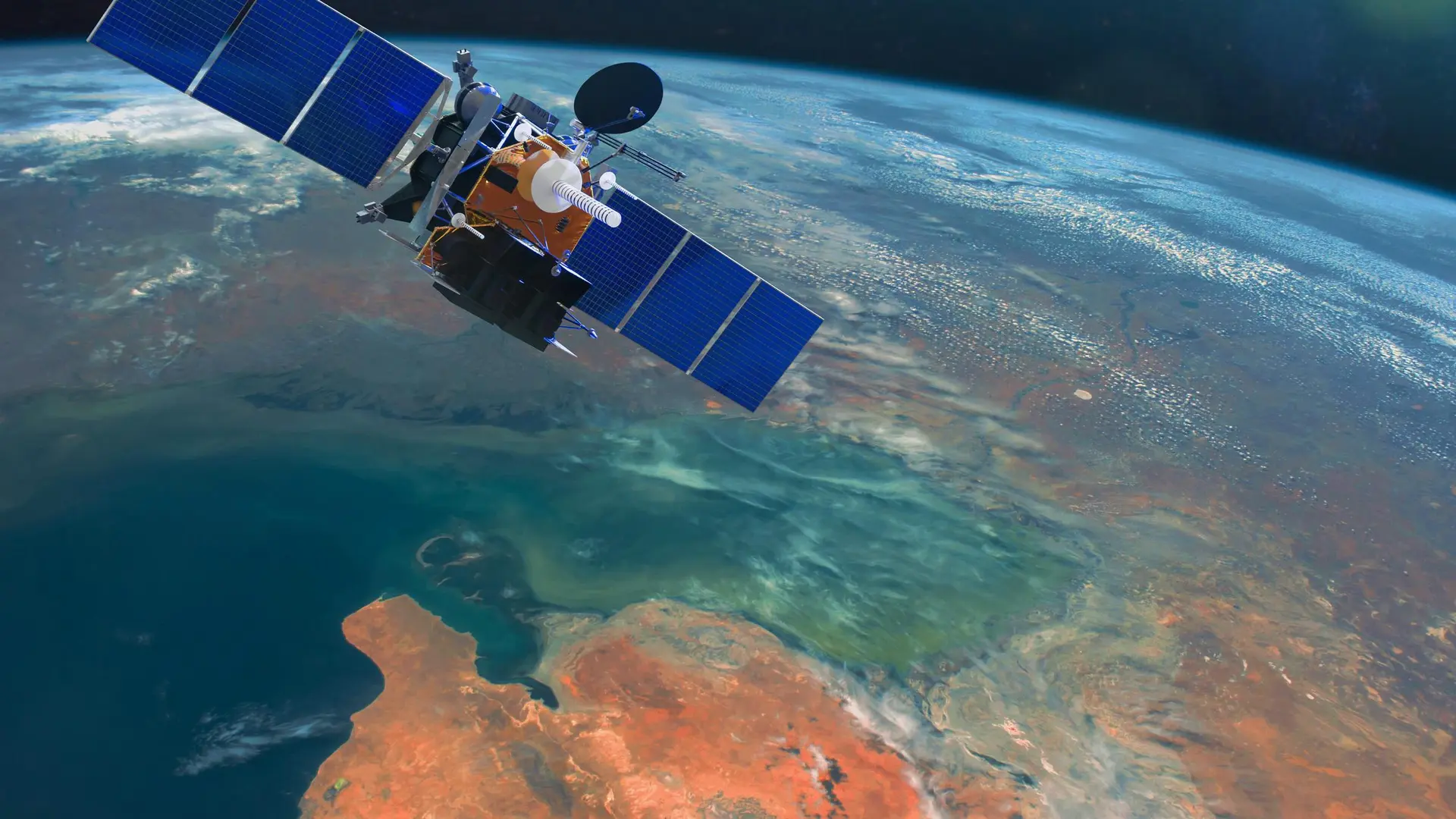
Geospatial data typically involves large sets of information that identify the geographic location and characteristics of features on Earth and can include information such as census data, satellite imagery, weather data, cell phone data, drawn images, and social media data.
The data is accessed through free tools such as Google Earth and Google Maps. Minerva has been using this data to promote accuracy in insurance payouts.
“There were disputes on claims assessments and settlement, especially on insured yield and insured hectarage; for example, a farmer would insure 100 hectares yet on the ground it is 50 hectares or 150 hectares,” says Simani Wadi, Minerva Risk Solutions managing director.
“Geo-spatial technology addresses issues of moral hazard where farmers might misrepresent the size of their crop or engage in poor agronomic practices to claim higher insurance payouts. By providing real-time and historical data on crop conditions and land use, the system ensures transparency, making it difficult for either party to manipulate claims, thus promoting honesty and trust in the insurance process.”
How it works
Minerva’s system allows insured farmers to provide Global Positioning System (GPS) coordinates of their fields, which will be mapped by a satellite system.
Using the Normalized Difference Vegetation Index (NDVI), a metric used for quantifying the health and density of vegetation using sensor data, it is easy to view insured fields from anywhere in the world.
The satellite system will enable the farmer and insurer to monitor and see the actual state of the crop without physical visitation.
“For a drought-stricken crop, a red or brownish colour as captured by satellite images will likely indicate a danger to the crop. A satellite system will also show the current and future rainfall patterns, thereby enabling the farmer to plan accordingly for any drought-related incidents,” Wadi says.
“The system will also give warnings for other related perils, e.g., risk of fires, frost, hail, windstorms, and cyclones. It can also measure the soil moisture index, thereby enabling farmers to plan and plant appropriate crops depending on soil type and pH conditions.”
Wadi says the new technology is now helping farmers and insurers monitor crops in times of disaster, to promote better yield.
“Insurers have often been accused of being ‘crooks’ by the insuring public, but with the advent of technology, this has minimized disputes between insurers and farmers. For instance, the planted hectarage is known by all parties, and the state of the crop is open for anyone to see and verify,” he says.
“In short, the satellite system has provided an independent and good refereeing platform for both farmers and insurers, thereby making crop insurance easier to administer. A well-managed crop insurance program will make premiums more economic in the future and will attract more farmers to insure their crops, thereby financially empowering the farmer.”
Future of AI and Geo-spatial data in agriculture
Tech and AI analyst Leonard Sengere says insurance companies should consider leveraging both Artificial Intelligence and geospatial data as much of risk assessment is based on regional estimates, resulting in generic policies.
“When it comes to risk assessment and mitigation, climate change has made this increasingly challenging. AI can help identify emerging risks earlier. By analyzing climate patterns, soil conditions, and pest outbreaks, AI can predict potential losses and provide farmers with proactive recommendations for mitigation, such as suggesting optimal planting times or pest control strategies. This benefits both farmers (by reducing losses) and insurers (by minimizing claims).”
He says while data has always been the lifeblood of insurance, companies should also consider ethical concerns, as geospatial data can reveal sensitive information about individuals and businesses, such as farm locations, crop types, and even personal activities.
“It is important for companies to comply with data privacy regulations and protect this information from unauthorized access or misuse. The potential consequences of this data falling into the wrong hands could be severe.
“Another equally important concern is bias and discrimination. Geospatial data can sometimes be inaccurate or biased, leading to unfair or incorrect assessments. For example, satellite imagery can be affected by cloud cover—something that DStv and Starlink know all too well—or algorithms may unintentionally favour certain regions or farming practices over others. Companies must validate data sources and actively address potential biases in their models.
State of agricultural insurance
Agricultural insurance has been making a considerable contribution to the short-term insurance sector, accounting for 11% of total short-term insurance revenue, according to a third-quarter report on short-term insurance by the Insurance and Pensions Commission (IPEC).
Last year, IPEC and the Agricultural Ministry launched the agricultural index insurance in the face of escalating climate change threats and limited capacity to withstand severe droughts, raising the need for risk mitigation for smallholder farmers.
However, Wadi says that Minerva will continue to explore AI in agricultural insurance to help farmers against shocks.
“On livestock insurance, for example, we are looking at introducing drought index insurance using satellite vegetative index platforms,” Wadi says.
“We keep on researching new trends and liaising with various service providers to get a variety of new products on offer. In our IT department, we have also started deliberately looking at qualifications that weigh more towards data analytics and AI in line with global trends.”